Dataset extent
Suomen rannikon ja järvien päivittäinen tarkan resoluution pintalämpötila-aineisto (Landsat-8/9, 100 m) / Daily high resolution water surface temperature of Finnish coast and lakes (Landsat-8/9, 100 m)
Data ja resurssit
Lisätietoja
| Kenttä | Arvo |
|---|---|
| Metatietueen ID | {12E84794-2793-4B20-B870-1DB6492B37D3} |
| Metatiedon pääasiallinen kieli | eng |
| Metatiedosta vastaava organisaatio | Suomen ympäristökeskus / Finnish Environment Institute (Syke) |
| Metatiedosta vastaavan organisaation yhteystieto | eotuki@syke.fi |
| Metatiedosta vastaavan organisaation rooli | pointOfContact |
| Metatiedon päivityspäivämäärä | 2026-03-03 |
| Koordinaattijärjestelmän EPSG-koodi, ks. https://epsg.io | EPSG:4326 |
| Aineiston/järjestelmän päivämäärä | 2021-08-20 |
| Aineiston/järjestelmän päivämäärän tyyppi | publication |
| Aineiston/järjestelmän yksilöivä tunnus | |
| Aineistosta/järjestelmästä vastaava organisaatio | Suomen ympäristökeskus / Finnish Environment Institute (Syke |
| Aineistosta/järjestelmästä vastaavan organisaation yhteystieto | eotuki@syke.fi |
| Aineistosta/järjestelmästä vastaavan organisaation rooli | pointOfContact |
| Esimerkkikuva | 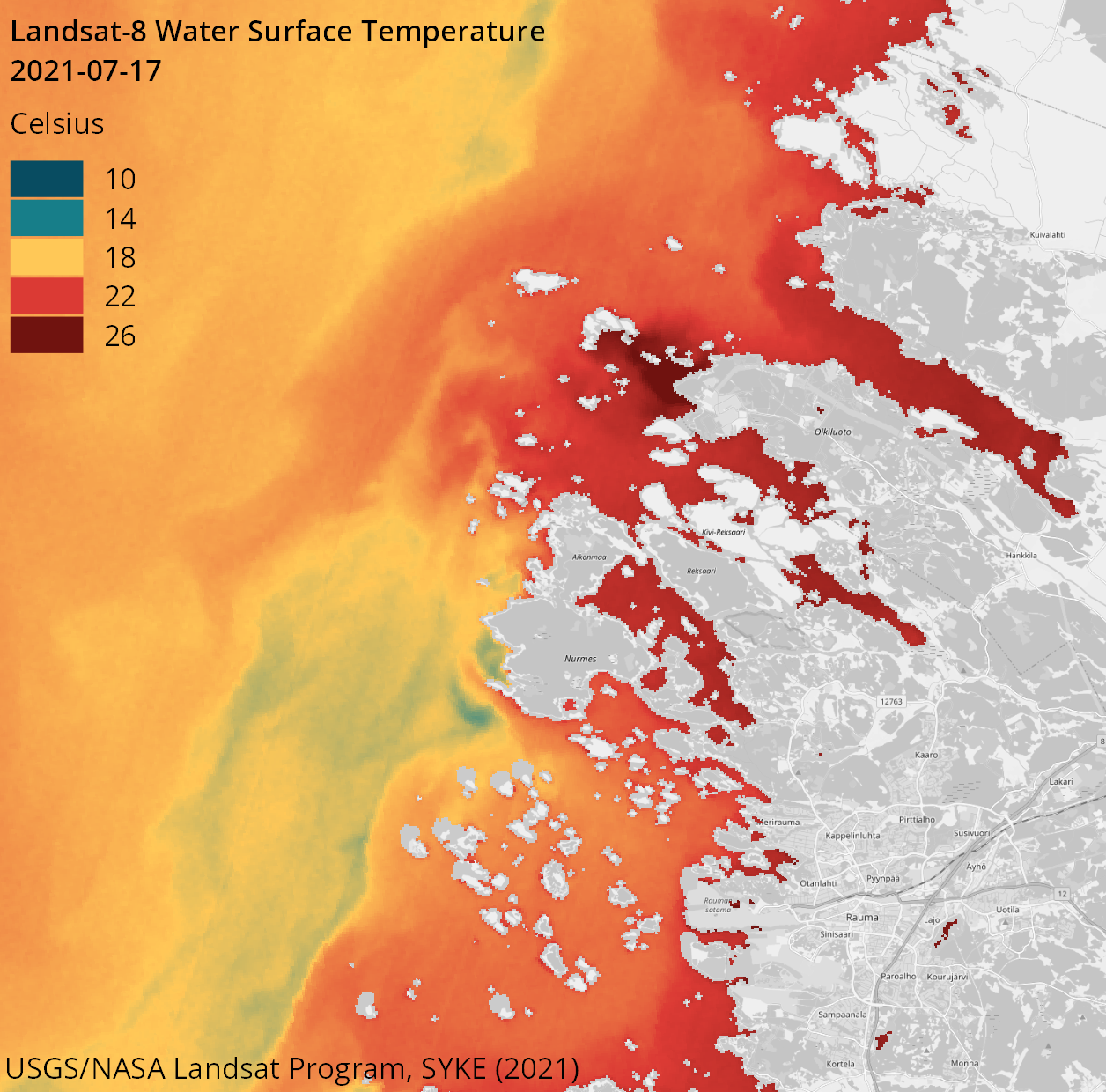 |
| INSPIRE-teema | Sea regions |
| GEMET-asiasana | remote sensing |
| GEMET-asiasana | earth observation |
| GEMET-asiasana | satellite image |
| GEMET-asiasana | coastal water |
| GEMET-asiasana | freshwater |
| GEMET-asiasana | inland water |
| GEMET-asiasana | sea water |
| GEMET-asiasana | surface water |
| GEMET-asiasana | water body |
| GEMET-asiasana | Water Framework Directive |
| GEMET-asiasana | water quality |
| GEMET-asiasana | temperature |
| Resurssityyppi | Satelliittihavaintotieto |
| Muut asiasanat | Ei-Inspire |
| Muut asiasanat: sanaston nimi | |
| Muut asiasanat | TARKKA |
| Muut asiasanat: sanaston nimi | |
| Muut asiasanat | status assessment |
| Muut asiasanat: sanaston nimi | |
| Käyttörajoitteet ja lähdemerkintä | Creative Commons Nimeä 4.0 Kansainvälinen [FI] Syke on mainittava lähteenä, jos tuotteita käytetään julkaisuissa tai esityksissä tai saatetaan muulla tavoin yleisön saataviin. Landsat-8/9 aineistoihin perustuva lämpötila: "Syke-aineisto, USGS/NASA Landsat Program (vuosi)" [EN] Syke must be cited as a source if the products are used in publications or performances or otherwise made available to the public. Surface temperature based on Landsat-8/9 data: "Syke data, USGS / NASA Landsat Program (year)" |
| Saantirajoitteet | no limitations |
| Aineiston/järjestelmän tyyppi | grid |
| Aineiston/järjestelmän kieli | eng |
| Aineiston/järjestelmän aiheluokka | environment |
| Aineiston/järjestelmän aiheluokka | oceans |
| Palvelun tyyppi | |
| Ajallisen kattavuuden alku | 2018-05-10 |
| Ajallisen kattavuuden loppu | now |
| Aineiston/tietojärjestelmän historiatiedot | - |