Dataset extent
Vesienhoitoalueet
Data and Resources
Additional Info
| Field | Value |
|---|---|
| File Identifier | {6AF42DE4-EB9A-4568-9E6C-90BEF19673D0} |
| Metadata Language | fin |
| Organisation responsible for metadata | Suomen ympäristökeskus |
| Contact information of the organisation responsible for metadata | gistuki@syke.fi |
| The role of the organisation responsible for metadata | pointOfContact |
| Metadata revision date | 2024-02-15 |
| EPSG Code of the Reference System, see https://epsg.io/ | EPSG:3067 |
| EPSG Code of the Reference System, see https://epsg.io/ | EPSG:3035 |
| Resource Date | 2005-01-01 |
| Resource Date Type | publication |
| Unique Resource identifier | http://paikkatiedot.fi/so/1002019/am/ManagementRestrictionOrRegulationZone |
| Organisation Responsible for Resource | Suomen ympäristökeskus |
| Contact information of the organisation responsible for Resource | gistuki@syke.fi |
| The role of the organisation responsible for Resource | owner |
| Thumbnail image | 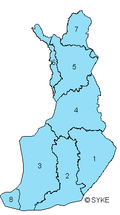 |
| INSPIRE Data Theme | Area management/restriction/regulation zones and reporting units |
| GEMET Concepts Keyword | environmental monitoring |
| INSPIRE Priority Dataset | Directive 2000/60/EC |
| INSPIRE Priority Dataset | River basin districts (Water Framework Directive) |
| INSPIRE Priority Dataset | Management units (Floods Directive) |
| INSPIRE Priority Dataset | Directive 2007/60/EC |
| Spatial Scope of INSPIRE data | National |
| Resource Classification | Paikkatietoaineisto |
| Other keywords | INSPIRE-tietotuote |
| Other keywords: Thesaurus name | |
| Other keywords | Ympäristön seuranta |
| Other keywords: Thesaurus name | |
| Other keywords | sisävedet ja meret |
| Other keywords: Thesaurus name | |
| Use constraints and source | Creative Commons Nimeä 4.0 Kansainvälinen http://www.syke.fi/fi-FI/Avoin_tieto/Kayttolupa_ja_vastuut Lähde: Syke |
| Access Constraints | no limitations |
| Representation Type | vector |
| Scale (Denominator) | 50000 |
| Resource Language | fin |
| Resource Topic Category | environment |
| Service Type | |
| Begin Date of Temporal Extent | unknown |
| End Date of Temporal Extent | unknown |
| Lineage Information | Vesienhoitoalue muodostuu yhdestä tai useammasta vesistöalueesta. Aineisto on tuotettu vesistöaluerajoista, jotka on rajattu mittakaavassa 1: 50 000. The dataset has been produced from the main river basin boundaries, outlined on a scale 1:50000. |