Dataset extent
Suomen päivittäinen vesi-indeksi NDWI (Sentinel-2) 2016– / Daily water index NDWI for Finland (Sentinel-2) 2016–
Data and Resources
Additional Info
| Field | Value |
|---|---|
| File Identifier | {13DBD235-7249-4E5C-8A63-822BD3A5D38A} |
| Metadata Language | fin |
| Organisation responsible for metadata | Suomen ympäristökeskus / Finnish Enviroment Institute (Syke) |
| Contact information of the organisation responsible for metadata | eotuki@syke.fi |
| The role of the organisation responsible for metadata | pointOfContact |
| Metadata revision date | 2025-02-24 |
| EPSG Code of the Reference System, see https://epsg.io/ | EPSG:4326 |
| Resource Date | 2023-10-04 |
| Resource Date Type | publication |
| Unique Resource identifier | |
| Organisation Responsible for Resource | Suomen ympäristökeskus / Finnish Enviroment Institute (Syke) |
| Contact information of the organisation responsible for Resource | eotuki@syke.fi |
| The role of the organisation responsible for Resource | pointOfContact |
| Thumbnail image | 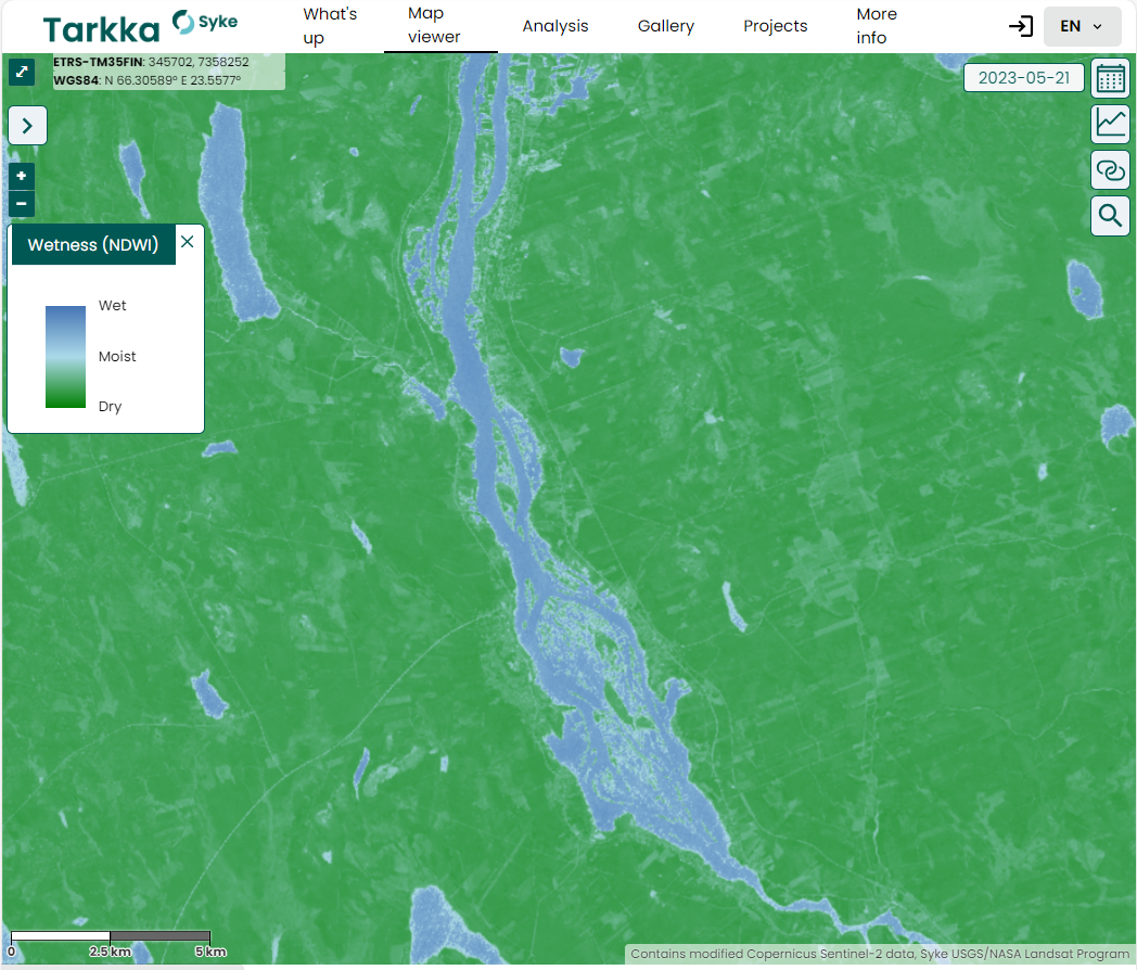 |
| INSPIRE Data Theme | Hydrography |
| INSPIRE Data Theme | Land cover |
| GEMET Concepts Keyword | moisture |
| GEMET Concepts Keyword | remote sensing |
| GEMET Concepts Keyword | earth observation |
| GEMET Concepts Keyword | satellite image |
| GEMET Concepts Keyword | index |
| Resource Classification | Satelliittihavaintotieto |
| Other keywords | Ei-Inspire |
| Other keywords: Thesaurus name | |
| Other keywords | Tarkka |
| Other keywords: Thesaurus name | |
| Other keywords | vesi-indeksi |
| Other keywords: Thesaurus name | |
| Other keywords | water index |
| Other keywords: Thesaurus name | |
| Other keywords | NDWI |
| Other keywords: Thesaurus name | |
| Use constraints and source | Creative Commons Nimeä 4.0 Kansainvälinen [FI] Syke on mainittava lähteenä, jos tuotteita käytetään julkaisuissa tai esityksissä tai saatetaan muulla tavoin yleisön saataviin. NDWI-aineistoa hyödynnettäessä täytyy mainita myös alkuperäisen datan toimittaja. Sentinel-2 NDWI-aineistolle "Sisältää muokattua Copernicus-dataa, Syke (vuosi)" [EN] Syke must be cited as a source if the products are used in publications or performances or otherwise made available to the public. When utilizing NDWI-data, the supplier of the original data must also be mentioned. For Sentinel-2 NDWI-data "Contains modified Copernicus data, Syke (year)" |
| Access Constraints | no limitations |
| Representation Type | grid |
| Resource Language | eng |
| Resource Topic Category | biota |
| Resource Topic Category | environment |
| Service Type | |
| Begin Date of Temporal Extent | 2016-08-24 |
| End Date of Temporal Extent | now |
| Lineage Information | - |