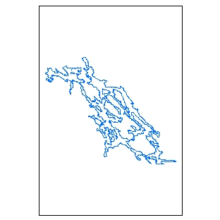
Dataset extent
Maastoliikenteen rajoitusalueet
Data and Resources
Additional Info
| Field | Value |
|---|---|
| File Identifier | {AFBC7507-2167-4224-8CBA-37E1B6C975A3} |
| Metadata Language | fin |
| Organisation responsible for metadata | Suomen ympäristökeskus |
| Contact information of the organisation responsible for metadata | gistuki@syke.fi |
| The role of the organisation responsible for metadata | pointOfContact |
| Metadata revision date | 2024-05-20 |
| EPSG Code of the Reference System, see https://epsg.io/ | EPSG:3067 |
| EPSG Code of the Reference System, see https://epsg.io/ | EPSG:3035 |
| Resource Date | 2000-01-01 |
| Resource Date Type | publication |
| Resource Date | 2022-05-03 |
| Resource Date Type | revision |
| Unique Resource identifier | http://paikkatiedot.fi/so/1002017/am/ManagementRestrictionOrRegulationZone |
| Organisation Responsible for Resource | Suomen ympäristökeskus |
| Contact information of the organisation responsible for Resource | gistuki@syke.fi |
| The role of the organisation responsible for Resource | owner |
| Thumbnail image |  |
| INSPIRE Data Theme | Area management/restriction/regulation zones and reporting units |
| GEMET Concepts Keyword | land use |
| Spatial Scope of INSPIRE data | National |
| Resource Classification | Paikkatietoaineisto |
| Other keywords | INSPIRE-tietotuote |
| Other keywords: Thesaurus name | |
| Other keywords | Maan havainnointi ja ympäristö |
| Other keywords: Thesaurus name | High-value dataset categories |
| Other keywords | Arvokkaat tietoaineistot |
| Other keywords: Thesaurus name | EU legislation |
| Other keywords | INSPIRE |
| Other keywords: Thesaurus name | EU legislation |
| Use constraints and source | Creative Commons Nimeä 4.0 Kansainvälinen http://www.syke.fi/fi-FI/Avoin_tieto/Kayttolupa_ja_vastuut Lähde: Syke, ELY-keskukset |
| Access Constraints | no limitations |
| Representation Type | vector |
| Scale (Denominator) | 20000 |
| Resource Language | fin |
| Resource Topic Category | transportation |
| Service Type | |
| Begin Date of Temporal Extent | unknown |
| End Date of Temporal Extent | unknown |
| Lineage Information | Kohteiden rajaukset on tehty pääsääntöisesti peruskarttarasteria tai numeerista rantaviiva-aineistoa apuna käyttäen 1:20 000 mittakaavassa. Aineistoa käytettäessä on huomioitava, että se sisältää osittain päällekkäisiä kohteita ja että aineisto ei ole juridisesti sitova. Päällekkäisten kohteiden vuoksi aineisto ei sovellu esimerkiksi tilastojen laskemiseen. Tarkat tiedot maastoliikennelain nojalla asetetuista liikennerajoituksista tulee tarkistaa alkuperäisistä päätösasiakirjoista. The restriction area delineations are done by using base maps in raster form or numeric coastal lines in scale 1:20 0000 as a source material. It should be noted that the dataset includes overlapping spatial objects and for this reason it is not suitable for statistical analyses. The dataset is not leagally binding. The exact information for spesific restriction areas given in accordance to the Land and Water Traffic Act should be checked from the original decision documents. |
