Dataset extent
Itämeren vesikasvillisuuden peittoala Suomessa ja Ruotsissa kesällä 2019/ Coverage of aquatic vegetation in Finland and Sweden in the Baltic Sea in summer 2019.
Data and Resources
Additional Info
| Field | Value |
|---|---|
| File Identifier | {BCAB0176-F959-464E-B709-E168FE8CA74F} |
| Metadata Language | fin |
| Organisation responsible for metadata | Suomen ympäristökeskus / Finnish Environment Institute (Syke) |
| Contact information of the organisation responsible for metadata | eotuki@syke.fi |
| The role of the organisation responsible for metadata | pointOfContact |
| Metadata revision date | 2023-05-19 |
| EPSG Code of the Reference System, see https://epsg.io/ | EPSG:3067 |
| Resource Date | 2021-11-16 |
| Resource Date Type | creation |
| Resource Date | 2021-11-17 |
| Resource Date Type | publication |
| Unique Resource identifier | |
| Organisation Responsible for Resource | Suomen ympäristökeskus / Finnish Environment Institute (Syke) |
| Contact information of the organisation responsible for Resource | eotuki@syke.fi |
| The role of the organisation responsible for Resource | pointOfContact |
| Thumbnail image | 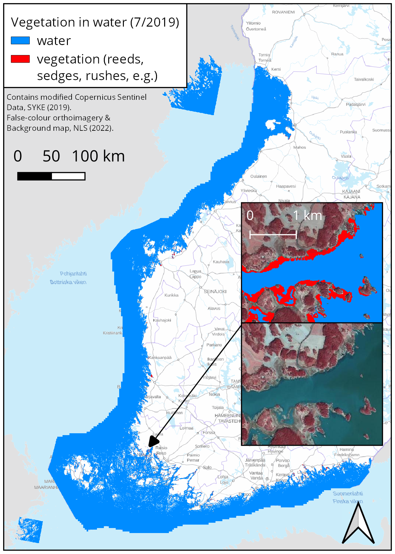 |
| INSPIRE Data Theme | Environmental monitoring facilities |
| INSPIRE Data Theme | Sea regions |
| GEMET Concepts Keyword | remote sensing |
| GEMET Concepts Keyword | earth observation |
| GEMET Concepts Keyword | satellite image |
| GEMET Concepts Keyword | coastal water |
| GEMET Concepts Keyword | ecological assessment |
| GEMET Concepts Keyword | ecological status |
| GEMET Concepts Keyword | eutrophication |
| GEMET Concepts Keyword | monitoring |
| GEMET Concepts Keyword | reed |
| Resource Classification | Satelliittihavaintotieto |
| Other keywords | Ei-Inspire |
| Other keywords: Thesaurus name | |
| Other keywords | reed belts |
| Other keywords: Thesaurus name | |
| Other keywords | FEO |
| Other keywords: Thesaurus name | |
| Use constraints and source | Creative Commons Nimeä 4.0 Kansainvälinen http://www.syke.fi/fi-FI/Avoin_tieto/Kayttolupa_ja_vastuut |
| Access Constraints | no limitations |
| Representation Type | grid |
| Resource Language | eng |
| Resource Topic Category | environment |
| Resource Topic Category | oceans |
| Service Type | |
| Begin Date of Temporal Extent | None |
| End Date of Temporal Extent | None |
| Lineage Information | [FI] Aineisto on ainutkertainen koeaineisto, joka on tuotettu päättyneen hankkeen tarpeisiin. Sitä ei enää ylläpidetä aktiivisesti. [EN] This is a unique test dataset produced for the needs of a completed project. It is no longer actively maintained. |