Dataset extent
Corine maanpeite 2000
Data and Resources
Additional Info
| Field | Value |
|---|---|
| File Identifier | {A70BC25F-43A2-4C33-A42D-9C22D9D4A3DB} |
| Metadata Language | fin |
| Organisation responsible for metadata | Suomen ympäristökeskus |
| Contact information of the organisation responsible for metadata | gistuki@syke.fi |
| The role of the organisation responsible for metadata | pointOfContact |
| Metadata revision date | 2024-05-20 |
| EPSG Code of the Reference System, see https://epsg.io/ | EPSG:3067 |
| EPSG Code of the Reference System, see https://epsg.io/ | EPSG:3035 |
| Resource Date | 2004-01-17 |
| Resource Date Type | publication |
| Unique Resource identifier | http://paikkatiedot.fi/so/1002006/lc/LandCoverUnit |
| Organisation Responsible for Resource | Suomen ympäristökeskus |
| Contact information of the organisation responsible for Resource | gistuki@syke.fi |
| The role of the organisation responsible for Resource | owner |
| Thumbnail image | 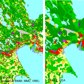 |
| INSPIRE Data Theme | Land cover |
| GEMET Concepts Keyword | land use |
| GEMET Concepts Keyword | environmental monitoring |
| Spatial Scope of INSPIRE data | National |
| Resource Classification | Paikkatietoaineisto |
| Other keywords | Maanpeite |
| Other keywords: Thesaurus name | |
| Other keywords | maankäyttö |
| Other keywords: Thesaurus name | |
| Other keywords | INSPIRE-tietotuote |
| Other keywords: Thesaurus name | |
| Other keywords | FEO |
| Other keywords: Thesaurus name | |
| Other keywords | Maan havainnointi ja ympäristö |
| Other keywords: Thesaurus name | High-value dataset categories |
| Other keywords | Arvokkaat tietoaineistot |
| Other keywords: Thesaurus name | EU legislation |
| Other keywords | INSPIRE |
| Other keywords: Thesaurus name | EU legislation |
| Use constraints and source | Creative Commons Nimeä 4.0 Kansainvälinen http://www.syke.fi/fi-FI/Avoin_tieto/Kayttolupa_ja_vastuut Lupatekstit Lähde: Syke, EEA (vektoriaineistolle) Lähde: Syke (osittain METLA,MMM,MML,DVV) (rasteriaineistolle) |
| Access Constraints | no limitations |
| Representation Type | vector |
| Scale (Denominator) | 100000 |
| Resource Language | fin |
| Resource Topic Category | environment |
| Service Type | |
| Begin Date of Temporal Extent | 2000-01-01 |
| End Date of Temporal Extent | unknown |
| Lineage Information | CLC2000 perustuu vuosina 1999 - 2002 otettuihin LANDSAT 7 ETM satelliittikuviin, joista tuotettiin IMAGE2000 -satelliittikuvamosaiikki ja maanpeitetietoa. Maanpeitetieto saatiin analysoimalla satelliittikuvilta mm. puuston pituutta ja peitteisyyttä, puulajisuhteita, kasvillisuustyyppiä ja –peittoa kuvaavia jatkuvia muuttujia. CLC2000- luokat on saatu kynnystämällä ja yhdistämällä maanpeitetietoja luokkamääritelmien mukaisesti. Satelliittikuvien kalibroinnissa ja tulkinnassa on käytetty VTT:n kehittämiä työkaluja, joita on edelleen kehitetty projektin aikana. Tulkinnassa tarvittavina maastotietoina on käytetty Metsähallituksen ja UPM:n metsä- ja biotooppikartoitusta. Lähtötietoina olevien paikkatietoaineiston päivitykseen (rakennetut alueet) sekä rantakosteikoiden luokitteluun käytettiin puoliautomaattista satelliittikuvien tulkintaa. Maanpeitetietojen yhdistäminen paikkatietoaineistojen kanssa: Satelliittikuvatulkinnan avulla saatava maanpeitteisyyttä kuvaava tieto yhdistettiin paikkatietoaineistojen sisältämän maankäyttö- ja maaperätiedon kanssa. Tärkeimmät lähdeaineistona käytetyt paikkatietoaineistot olivat SLICES-maankäyttöaineisto, Maastotietokannan maaperätiedot ja Digi- ja väestötietoviraston Väestötietojärjestelmä (Rakennus- ja huoneistorekisteri). Suomessa tuotettiin rasterimuotoinen paikkatietoaineisto, jossa pienin kartoitettava yksikkö vastaa maastossa 25 x 25 metrin alaa. CORINE- määritysten mukainen vektoriaineisto tuotettiin yleistämällä kansallista rasteriaineistoa tätä tarkoitusta varten kehitetyllä automaattisella yleistysprosessilla. Yleistetyn aineiston pienin maastossa erottuva alue on vähintään 25 ha ja kapeimmillaan 100 metriä. Satellite image interpretation IMAGE2000 satellite image mosaic, which the CLC2000 is based on, consists of LANDSAT 7 ETM satellite images taken during 1999-2000. The selected satellite images were geometrically corrected by Metria Sweden. Radiometric preprocessing included atmospheric correction and topographic correction in Northern Finland. The mosaicking of individual satellite images was carried out in order to get stratumwise and nationwide mosaics for interpretation and visualization purposes. In forests and semi-natural areas as well as in wetlands following land cover variables were estimated from the satellite images: tree height (m), tree crown cover (%), volume of broadleaved trees (m3/ha) and total volume (m3/ha). Additionally in northern Finland ground vegetation type was estimated for non-forested areas. Continuous land cover variables were transformed into discrete CORINE classes by thresholding the variables according to the class descriptions in CORINE nomenclature. Syke and the Technical Research Centre of Finland (VTT) developed a production line based on calibration of satellite measurements and automated satellite image interpretation. Metsähallitus and UPM provided field datasets. Finnish Forest Research Institute validated the forest and semi-natural areas using National Forest Inventory Data. Data integration with GIS data Satellite image derived land cover data were combined with existing digital land use and soil information. The principal geographic data sources were SLICES- land use database, soil information from the Topographic Database of Finland produced by the National Land Survey of Finland and the Population Information System produced by Population Register Centre. Detailed class definitions and production methods can be found in annex documents. The resulting national raster database (25m x 25 m) was generalized according to the CORINE 2000 project class definitions. |