Service endpoint: https://geoserver2.ymparisto.fi/geoserver/algaline
Service layer: algaline:transect_measurements
[FI]
Palvelu sisältää Algaline-läpivirtajärjestelmän vedenlaatumittaukset. Algaline-järjestelmä koostuu Itämerellä kulkeviin merialuksiin asennetuista automaattisista mittauslaitteistoista. Kukin laitteisto tuottaa automaattimittauksia useista vedenlaatua kuvaavista parametreista noin 20 sekunnin välein aluksen reitiltä.
Tämä rajapintapalvelu sisältää läpivirtalaitteiston vedenlaatumittaukset vuodesta 1998 eteenpäin. Havainnot on käytettävissä OGC-yhteensopivilla WMS ja WFS -pyynnöillä. Palvelun aineisto päivittyy tunneittain.
Palvelun sisältämien pistekohteiden attribuutit ovat:
- time = mittaustapahtuman ajanhetki (UTC0)
- lat, lon = mittaustapahtuman koordinaatit WGS84 (EPSG:4326) järjestelmässä
- vessel_speed = aluksen nopeus mittaushetkellä (solmua)
- parameter_group = mitatun parametrin ryhmittelytunnus; arvot:
- parameter_name = mitatun parametrin nimi; arvot:
- sochlfl = flow-through in vivo chl fluorescence
- sopcfl = flow-through in vivo pc fluorescence
- sosal = flow-through salinity
- soxtemp = flow-through temperature by separate sensor
- sotemp = flow-through temperature by temp-sal-sensor
- soturb = flow-through turbidity
- soflow = flow-through flowrate
- value = parametrin mitattu arvo (numeerinen; yksikkö riippuu parametrista)
- meta_vesselname = aluksen nimi
- meta_transect_gid = aluksen reitin (transekti) yksilöivä tunniste
- meta_point_gid = mittaustapahtuman yksilöivä tunniste
- qa_quality_id = mittauksen laatuluokka SeaDataNet L20 BODC -yhteensopivana laatukoodina
- 174118 = luotettava arvo ("good value" -luokka L20 BODC -koodistossa)
- 174121 = epäluotettava arvo ("bad value" -luokka L20 BODC -koodistossa)
- (null) = laatutieto ei saatavilla
SeaDataNet L20 BODC laatuluokitus on saatavilla.
Muut attribuutit ovat teknisten järjestelmien ohjaukseen eivätkä ole tarkoitettu loppukäyttäjän käytettäväksi.
Rajapinnan käyttö edellyttää OGC-standardin ja Geoserver-spesifin CQL-suodatuksen käytön tuntemista. Esimerkki: parametrin sotemp mittaustulokset aikavälillä 2020-08-01/2020-08-02 saa palvelusta JSON-muodossa seuraavalla pyynnöllä:
https://geoserver2.ymparisto.fi/geoserver/algaline/wfs?service=wfs&version=2.0.0&request=GetFeature&typeNames=transect_measurements&outputFormat=application/json&cql_filter=time%20DURING%202020-08-01T00:00:00%2f2020-08-02T00:00:00%20AND%20parameter_name=%27sotemp%27
Aineisto kuuluu SYKEn avoimiin aineistoihin (CC BY 4.0).
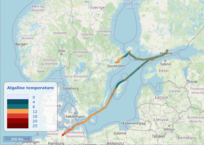
[EN] The service contains flow-through water quality measurements produced by the Algaline system. The Algaline system consists of automatic observation units on-board commercial marine vessels at the Baltic Sea. Each observation unit performs automatic measurements using a flow-through system in approximately 20 second intervals along the vessel transect. A transect is one continuous voyage from one harbour to another.
This API-service contains flow-through water quality measurements starting from year 1998, accessible by OGC-compliant WMS and WFS-requests. The service is updated hourly.
The available attributes for each measurement are:
- time = time of he measurement event (UTC0)
- lat, lon = WGS84 (EPSG:4326) coordinates of the measurement event
- vessel_speed = speed of the ship during the measurement event (kn)
- parameter_group = group designation of the measured parameter; values:
- flow = flow-through measurement
- parameter_name = name of the measured parameter; values:
- sochlfl = flow-through in vivo chl fluorescence
- sopcfl = flow-through in vivo pc fluorescence
- sosal = flow-through salinity
- soxtemp = flow-through temperature by separate sensor
- sotemp = flow-through temperature by temp-sal-sensor
- soturb = flow-through turbidity
- soflow = flow-through flowrate
- value = result of the measurement event (numerical; unit depends on the parameter)
- meta_vesselname = name of the ship
- meta_transect_gid = unique identifier for the transect that the ship is traveling
- meta_point_gid = unique identifier for the spatiotemporal measurement event
- qa_quality_id = the quality flag identificator as a SeaDataNet L20 BODC compliant quality code
- 174118 = good value (in L20 BODC)
- 174121 = bad value (in L20 BODC)
- (null) = Quality flag not available
Note, that qa_quality_id values conform to the SeaDataNet L20 BODC vocabulary defined at https://vocab.seadatanet.org/search.
Other available attributes are for technical control and are not intended for public use.
The intended use case for the API is to request measurements for designated parameter and time interval.
To get the actual numerical data, use WFS-service and CQL-filter for filtering for desired parameter and time range. For example, measurement results for parameter sotemp during 2020-08-01/2020-08-02 as JSON can be requested using the following URL:
https://geoserver2.ymparisto.fi/geoserver/algaline/wfs?service=wfs&version=2.0.0&request=GetFeature&typeNames=transect_measurements&outputFormat=application/json&cql_filter=time%20DURING%202020-08-01T00:00:00%2f2020-08-02T00:00:00%20AND%20parameter_name=%27sotemp%27