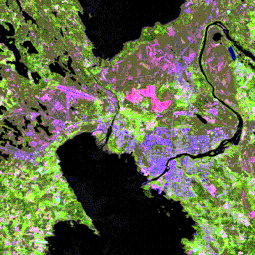
Dataset extent
Satelliittikuvamosaiikki (Image2000)
Data and Resources
Additional Info
| Field | Value |
|---|---|
| File Identifier | {0FD2F424-2C22-4384-A0C6-65AF19DED2A9} |
| Metadata Language | fin |
| Organisation responsible for metadata | Suomen ympäristökeskus |
| Contact information of the organisation responsible for metadata | gistuki@syke.fi |
| The role of the organisation responsible for metadata | pointOfContact |
| Metadata revision date | 2024-02-15 |
| EPSG Code of the Reference System, see https://epsg.io/ | EPSG:3067 |
| EPSG Code of the Reference System, see https://epsg.io/ | EPSG:3035 |
| Resource Date | 2004-12-31 |
| Resource Date Type | revision |
| Unique Resource identifier | http://paikkatiedot.fi/so/1002008/oi/OrthoimageCoverage |
| Organisation Responsible for Resource | Suomen ympäristökeskus |
| Contact information of the organisation responsible for Resource | gistuki@syke.fi |
| The role of the organisation responsible for Resource | owner |
| Thumbnail image |  |
| INSPIRE Data Theme | Orthoimagery |
| GEMET Concepts Keyword | remote sensing |
| GEMET Concepts Keyword | aerial photograph |
| Spatial Scope of INSPIRE data | National |
| Resource Classification | Paikkatietoaineisto |
| Other keywords | satelliittikuva |
| Other keywords: Thesaurus name | |
| Other keywords | INSPIRE-tietotuote |
| Other keywords: Thesaurus name | |
| Other keywords | FEO |
| Other keywords: Thesaurus name | |
| Use constraints and source | Creative Commons Nimeä 4.0 Kansainvälinen http://www.syke.fi/fi-FI/Avoin_tieto/Kayttolupa_ja_vastuut Lupateksti Lähde: Syke, JRC, ESA, Metria |
| Access Constraints | no limitations |
| Representation Type | grid |
| Scale (Denominator) | 100000 |
| Resource Language | fin |
| Resource Topic Category | environment |
| Service Type | |
| Begin Date of Temporal Extent | 2000-01-01 |
| End Date of Temporal Extent | unknown |
| Lineage Information | CLC2000 perustuu vuosina 1999 - 2002 otettuihin LANDSAT 7 ETM satelliittikuviin, joista tuotettiin IMAGE2000 -satelliittikuvamosaiikki ja maanpeitetietoa. Yksittäiset satelliittikuvat kalibroitiin radiometrisesti, ilmakehän vaikutusta korjattiin ja Lapissa tehtiin topografiakorjaus. Yksittäisten kuvien pilvettömistä alueista koottiin kasvillisuusvyöhykkeittäin kuvamosaiikki, joka yhdistettiin koko Suomen kattavaksi. Satelliittikuvien kalibroinnissa ja tulkinnassa on käytetty VTT:n kehittämiä työkaluja, joita on edelleen kehitetty projektin aikana. Tulkinnassa tarvittavina maastotietoina on käytetty Metsähallituksen ja UPM:n metsä- ja biotooppikartoitusta. JRC on tuottanut koko Euroopan kattavan mosaiikin, joka poikkeaa Suomen vastaavasta aineistosta. |
