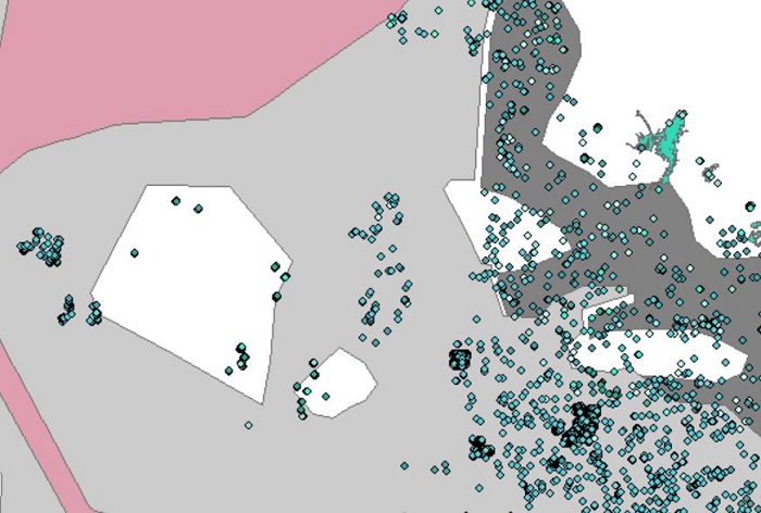
Dataset extent
LuTU2018 Itämeren luontotyyppien esiintymäaineistot uhanalaisuusarvioinnissa
Data and Resources
Additional Info
| Field | Value |
|---|---|
| File Identifier | {C15A3E1B-BBEB-4D80-95AC-742DC71FD30F} |
| Metadata Language | fin |
| Organisation responsible for metadata | Suomen ympäristökeskus |
| Contact information of the organisation responsible for metadata | gistuki@syke.fi |
| The role of the organisation responsible for metadata | pointOfContact |
| Metadata revision date | 2023-12-14 |
| EPSG Code of the Reference System, see https://epsg.io/ | EPSG:3067 |
| Resource Date | 2022-05-03 |
| Resource Date Type | publication |
| Resource Date | 2022-11-15 |
| Resource Date Type | revision |
| Unique Resource identifier | |
| Organisation Responsible for Resource | Suomen ympäristökeskus |
| Contact information of the organisation responsible for Resource | gistuki@syke.fi |
| The role of the organisation responsible for Resource | pointOfContact |
| Thumbnail image |  |
| INSPIRE Data Theme | Habitats and biotopes |
| GEMET Concepts Keyword | benthic ecosystem |
| GEMET Concepts Keyword | biotope |
| GEMET Concepts Keyword | brackish water |
| GEMET Concepts Keyword | ecosystem |
| GEMET Concepts Keyword | ecosystem assessment |
| GEMET Concepts Keyword | habitat |
| GEMET Concepts Keyword | macrophyte |
| GEMET Concepts Keyword | marine ecosystem |
| GEMET Concepts Keyword | ice |
| GEMET Concepts Keyword | open sea |
| GEMET Concepts Keyword | estuary |
| Resource Classification | Paikkatietoaineisto |
| Other keywords | Ei-Inspire |
| Other keywords: Thesaurus name | |
| Other keywords | meriluontotyypit |
| Other keywords: Thesaurus name | |
| Other keywords | luontotyypit |
| Other keywords: Thesaurus name | |
| Other keywords | uhanalaiset luontotyypit |
| Other keywords: Thesaurus name | |
| Other keywords | luontotyyppien uhanalaisuus |
| Other keywords: Thesaurus name | |
| Other keywords | Red List of Ecosystems |
| Other keywords: Thesaurus name | |
| Other keywords | threatened habitat types |
| Other keywords: Thesaurus name | |
| Other keywords | FEO |
| Other keywords: Thesaurus name | |
| Use constraints and source | Creative Commons Nimeä 4.0 Kansainvälinen https://www.syke.fi/fi-FI/Avoin_tieto/Kayttolupa_ja_vastuut. Lähde: Syke This dataset of Syke can be used according to open data license (CC BY 4.0) |
| Access Constraints | no limitations |
| Representation Type | vector |
| Scale (Denominator) | 10000 |
| Resource Language | fin |
| Resource Topic Category | biota |
| Resource Topic Category | environment |
| Resource Topic Category | oceans |
| Service Type | |
| Begin Date of Temporal Extent | None |
| End Date of Temporal Extent | None |
| Lineage Information | 1) Merenpohjan luontotyypit: Aineisto on muodostettu Metsähallituksessa Vedenalaisen meriluonnon monimuotoisuuden inventointiohjelma Velmun tutkimusaineistosta tulkitsemalla kunkin havaintopisteen lajien runsaussuhteista merenpohjan luontotyyppi vallitsevien kasvi- tai eläinlajien perusteella. Luontotyyppien uhanalaisuusarvioinnin meriluontotyypit pohjautuvat pääosin HELCOM:n vedenalaisten biotooppien ja habitaattien HUB-luokittelujärjestelmään (https://helcom.fi/baltic-sea-trends/biodiversity/helcom-hub/). Poikkeukset HUB-luokittelusta kuvaa Kotilainen ym. (2018): Itämeri. Julk.: Kontula, T. & Raunio, A. (toim.). Suomen luontotyyppien uhanalaisuus 2018. Luontotyyppien punainen kirja – Osa 1: Tulokset ja arvioinnin perusteet. Suomen ympäristökeskus & ympäristöministeriö, Helsinki. Suomen ympäristö 5/2018. s. 47–62. 2) Ulappatyypit: HELCOM-aluejaon avulla Suomen merialueelle ja talousvyöhykkeelle muodostettu ulappa-alueaineisto 3) Merijää: Aineisto on digitoitu julkaisusta Kaartokallio ym. (2017). Tavoitteena on ollut tuottaa 10 km x 10 km -ruutujen tarkkuudella merijään esiintymisaineisto, joten aineiston polygonit eivät seuraa tarkkaa Itämeren rantaviivaa. 4) Rannikon jokisuistot: muodostettu SYKEn Ranta10-aineiston ja Hertta-tietojärjestelmän virtaamatietojen avulla. Tarkemmat tiedot aineistojen muodostamisesta aineiston ominaisuustietojen liitedokumentissa. Aineiston sijainti tietokannassa ..\gis\data\luonto\LuTU2018Esiintymat.gdb LuTU2018MerenpohjanLuontotyypit LuTU2018Ulappatyypit LuTU2018Merijaa LuTU2018Rannikon_jokisuistot Aineistot ovat alkuperäismuodossa, eikä niiden geometriaa ole korjattu. Benthic habitats: Comprised by Metsähallitus by identifying the predominant species or groups of species of benthic flora or fauna using the data from the Finnish inventory programme for underwater marine diversity. The habitat types used in the threat assessment are mostly based on HELCOM HUB Helcom Underwater Biotope and Habitat Classification System (https://helcom.fi/baltic-sea-trends/biodiversity/helcom-hub/). Exceptions to the HUB classification can be found in Kotilainen et al. (2018) (http://hdl.handle.net/10138/308426, p. 49-59). Pelagic habitats: Occurrences of pelagic habitats in the Baltic Sea (Finland’s marine area including the exclusive economic zone) based on HELCOM classification. Sea ice: The dataset is digitized from the publication of Kaartokallio et al. (2017). The aim was to produce a dataset of the sea ice using a 10 km x 10 km spatial resolution. Therefore, polygons in the dataset do not entirely match with the Baltic Sea coastline. Reference to the original publication: Kaartokallio, H., Granskog, M. A., Kuosa, H. & Vainio, J. 2017. Chapter 27: Ice in subarctic seas. Publ.: Thomas, D. N. (eds.). Sea Ice. 3rd edition.John Wiley & Sons, Chichester, UK. S. 630–644. Coastal estuaries: Comprised by Metsähallitus using the discharge data from Syke’s Ranta10 dataset and Hertta environmental data service. The datasets are in their original formats and without any geometry corrections. |
