Historical Landsat image index mosaics (Hind) – Historialliset Landsat-kuvaindeksimosaiikit (Hind)
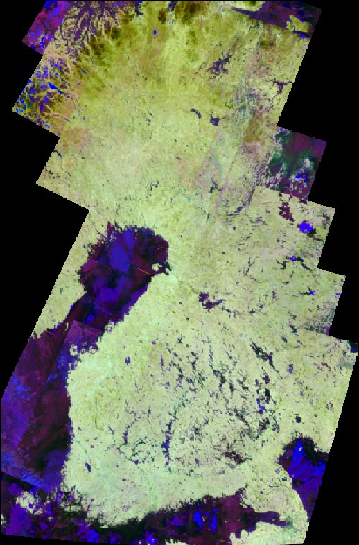
The image index mosaics called Hind are computed from images acquired using Landsat-4 and -5 satellites. These mosaics are computed for years 1984 – 2011. The purpose of these index mosaics is to enhance some physical property of target, like vegetation or built-up areas. Computed image indices are Normalized Difference Vegetation Index (NDVI), Tillage Index (NDTI), NDBI (Built-up index), NDSI (Snow index) and NDMI (Moisture index).
Historical Landsat-4/5 image index mosaics are produced using images acquired using the Thematic Mapper-instrument onboard of the Landsat-4 and -5 satellites. The original data was downloaded from European Space Agency and processed at CalFin-cluster of Finnish National Satellite Data Centre.
Following image indices are computed:
- NDVI = (B4-B3)/(B4+B3)
- NDTI = (B5-B7)/(B5+B7)
- NDMI = (B4-B5)/(B4+B5)
- NDBI = ((B5-B4)/(B5+B4))-((B4-B3)/(B4+B43))
- NDSI = (B2-B5)/(B2+B5)
where B* indicates the Landsat Thematic Mapper image band Top-of-Atmosphere reflectance used in index computation.
The mosaics are composed based on maximum NDVI of the year, in other words the pixel values to mosaics are selected from image where the NDVI value is the highest within that year. Then, pixel values are scaled from interval -1,...,1 to interval 0,...,200 and saved as 8-bit integers instead of 32-bit real numbers. This has been done in order to reduce data size. The coordinate system is TM35Fin (EPSG 3067). The mosaics are stored as Cloud-Optimized-Geotiff files. The final spatial resolution of Hind-image index mosaics is 30 m per pixel. The metadata mosaic, in other words the number of day of the year, is called META.
The mosaics are available for download from the S3-bucket of NSDC using URL, like
where
TYPE: the type of mosaic, NDVI, NDTI, NDMI, NDBI or NDSI for different image indices and META for metadata mosaic (use capital letters)
year: the year of the mosaic, 1984 - 2011
These S2ind-mosaics are produced as part of sub program “Distribution and Processing of Satellite Imagery” of "Geospatial Platform of Finnish Public Administration"-program. The license for Syke's open datasets is Creative Commons Attribution 4.0 International.
Historialliset Landsat-kuvaindeksimosaiikit (Hind)
Hind-kuvaindeksimosaiikit on laskettu Landsat-4 ja -5 satelliittien Thematic Mapper-instrumenttien ottamista kuvista. Mosaiikit on laskettu vuosille 1984 - 2011. Alkuperäiset Landsat-kuvat on ladattu Euroopan avaruusjärjestön arkistosta ja indeksimosaiikit laskettu käyttäen Kansallisen satelliittidatakeskuksen CalFin-laskentaklusteria. Kuvaindeksit ovat normalisoitu kasvillisuusindeksi NDVI, normalisoitu kyntöindeksi NDTI, normalisoitu kosteusindeksi NDMI, normalisoitu rakennetun indeksi NDBI ja normalisoitu lumi-indeksi. Näiden indeksien tarkoituksena on korostaa jotain kuvalla esiintyvää ominaisuutta kuten kasvillisuutta tai kosteutta.
Lasketut kuvaindeksit ovat:
- NDVI = (B4-B3)/(B4+B3)
- NDTI = (B5-B7)/(B5+B7)
- NDMI = (B4-B5)/(B4+B5)
- NDBI = ((B5-B4)/(B5+B4))-((B4-B3)/(B4+B43))
- NDSI = (B2-B5)/(B2+B5)
jossa B* tarkoittaa indeksin laskennassa käytettävää Landsat-4/5 Thematic Mapper instrumentin kanavaa.
Mosaiikin pikselin valinta perustuu NDVI:n vuotuiseen maksimiarvoon, eli kaikilta vuoden kuvilta lasketaan NDVI sekä muut indeksit ja mosaiikin pikselin valitaan se jonka NDVI on suurin. Pikselien arvot skaalataan siten että lukualue -1,...,1 muuttuu lukualueeksi 0,...,200 ja tulos tallennetaan käyttäen 8-bittisiä kokonaislukuja. Mosaiikkien koordinaattijärjestelmä on TM35Fin (EPSG 3067). Mosaiikkien tiedostoformaatti on Cloud-Optimized-Geotiff. Pikselikoko on 30 metriä. Metatietomosaiikki joka ilmaisee valitun pikselin kuvauspäivän on META.
Mosaiikit ovat ladattavissa Kansallisen satelliittidatakeskuksen S3-bucket järjestelmästä URL:n avulla:
jossa
- TYPE: mosaiikin tyyppi eli NDVI, NDTI, NDMI, NDBI tai NDSI eri kuvaindekseille ja META metatietomosaiikille
- year: mosaiikin vuosi, 1984 - 2011
Mosaiikit on tuotettu osana Paikkatietoalusta-hankkeen osahanketta Satelliittikuvien jakelu ja prosessointi. Syke:n avoimien tietojen lisenssi on Creative Commons Attribution 4.0 International.